Introduction
When it comes to drones, most readers are familiar with their rapid development driven by distinctive designs and practical functions. Entering the 5G era will bring another leap in drone technology, upgrading performance and expanding application scenarios.
Traditional Drones
Drones are unmanned aerial vehicles (UAVs) that execute specific aerial tasks using remote wireless control or programmed control. The main difference from conventional aircraft is whether the aircraft carries people.
The history of unmanned aerial vehicles stretches back around a century. For a long time they were primarily used for military purposes, such as target drones and reconnaissance. In the 21st century military UAVs became highly capable and prominent.
As drone technology matured, it expanded into civil use with a wide range of platforms and applications. Civil drones include fixed-wing, rotary-wing, flapping-wing, parafoil, and airship types. The most commonly seen are rotary-wing drones used in agriculture, logistics, aerial filming, light shows, and other civilian applications.
Connected Drones
Typical rotary-wing civil drones consist of a frame, power system, flight control system, and payload. Groundside systems include the operator station and control devices. Traditional control uses point-to-point communication between a remote controller and the drone, typically over Wi-Fi or Bluetooth.
Wi-Fi and Bluetooth have limited range. Wi-Fi control usually works within visual line of sight, typically 300–500 meters (in some conditions over 1 km). Bluetooth range is even shorter. This constraint limits drone flight range because operators generally will not let a drone fly too far for fear of losing the control link and causing a crash. To address this, cellular-connected drones have emerged.
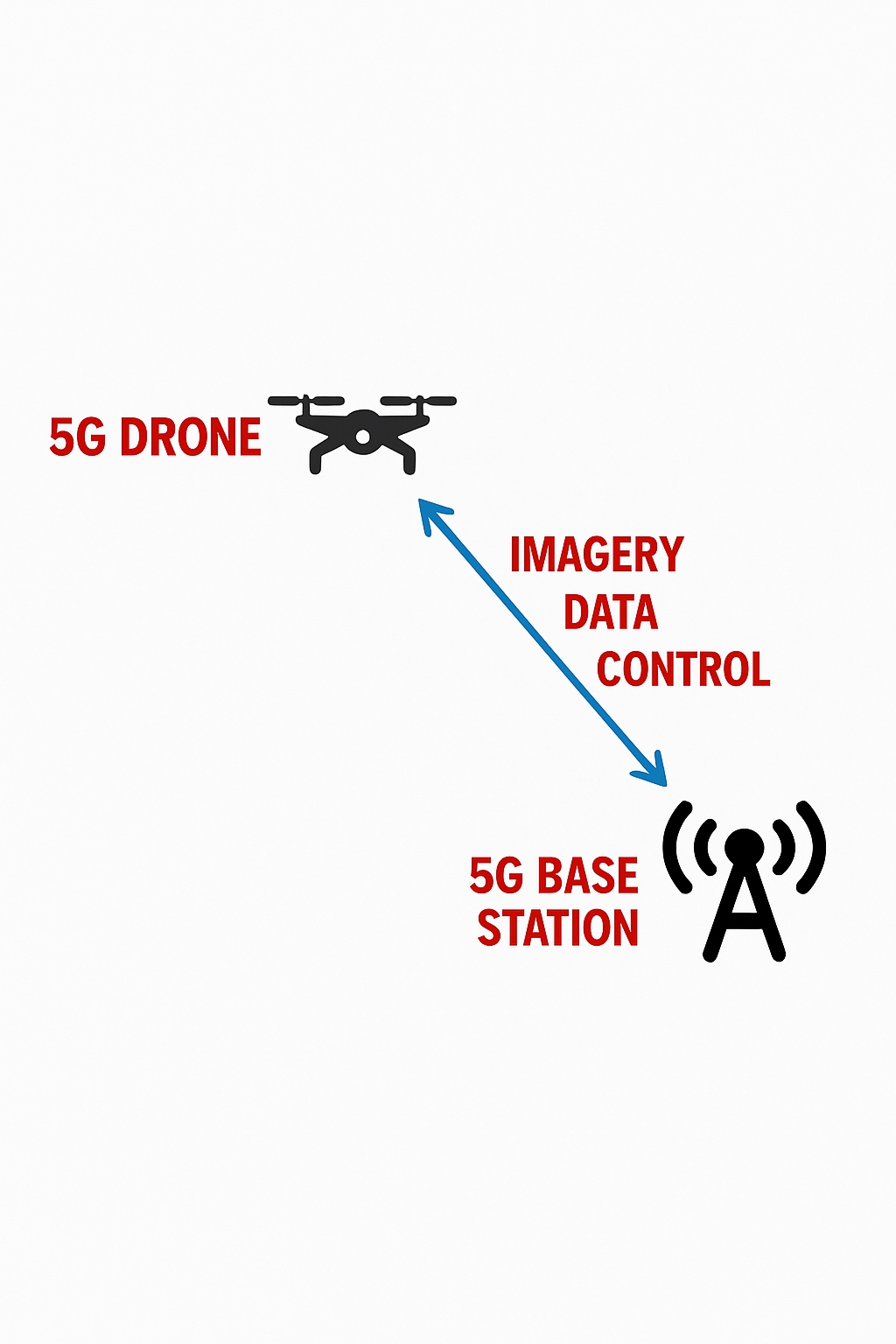
Cellular-connected drones use mobile networks and base stations to connect and control drones, providing broader coverage than Wi-Fi and more flexible, reliable communications.
Drone-to-ground communications serve three main purposes: video transmission, data transmission, and remote control.
Video transmission sends camera footage from the drone pod back to the ground. Data transmission delivers sensor and flight data. Video transmission places the highest demands on communication capability. Using Wi-Fi point-to-point, video transmission typically maxes out at about 1080p (1920×1080) at ~30 fps within a few hundred meters, though some vendors have proprietary systems claiming multi-kilometer ranges at 1080p.
With 4G LTE cellular connectivity, where base stations provide coverage, range is effectively unrestricted by distance, but video quality has typically been around 720p (1280×720). For some aerial inspection tasks that require reading instrument indicators or identifying faces, 720p or 1080p may not be sufficient.
Regarding positioning, existing 4G network positioning accuracy in the air is on the order of tens of meters, while GPS provides meter-level accuracy. Applications requiring higher positioning precision, such as campus logistics or complex terrain navigation, may need additional reference stations. In terms of altitude coverage, 4G networks generally only support applications below about 120 meters; above that, such as high-altitude surveying or trunk-line logistics, loss of contact becomes more likely.
Overall, current 4G and Wi-Fi based drone deployment faces many constraints that limit application scenarios and user adoption in the consumer market, restricting long-term development and value realization.
5G-Enabled Drones
5G addresses many limitations of earlier connectivity technologies. Key advantages include much greater bandwidth, lower latency, higher positioning precision, wider airspace coverage, and improved security.
Bandwidth is a primary 5G feature. Theoretical 5G throughput can exceed 20 Gbps, and experimental networks commonly reach 1 Gbps or more, an order of magnitude higher than 4G LTE. This enables not only 720p and 1080p but also 4K and 8K ultra-high-definition video streaming from drones.
Compared with fixed ground cameras, drones combined with 5G can provide dynamic, high-angle, ultra-high-definition wide-angle views. With sufficient bandwidth, drones can carry 360° panoramic camera pods for multidimensional capture, and ground operators can view multi-angle feeds using VR headsets.
Low latency is another 5G advantage. 5G can provide millisecond-level transmission delays (below 20 ms and potentially as low as 1 ms), while 4G LTE latency is typically above 50 ms. Lower latency enables faster responses to ground commands and more precise control.
5G can also support centimeter-level positioning accuracy, which is far better than LTE’s ten-meter level and GPS meter-level accuracy. This improves flight performance in complex urban environments.
Massive MIMO antenna arrays and beamforming techniques allow dynamic adjustment of transmission phases in both horizontal and vertical planes. This improves coverage for airborne targets at certain heights and supports regulatory requirements for low-altitude airspace below 500 meters, as well as future higher-altitude urban operations.
On the security front, 5G improves data transmission reliability and makes wireless channels less susceptible to interference or intrusion compared with 4G and Wi-Fi.
Beyond link improvements, 5G enhances the supporting system architecture. A complete drone system includes airborne and ground components. Traditional Wi-Fi control limits the groundside to a controller and a mobile device. Cellular-connected drones benefit from stronger ground platforms combined with cloud computing, enabling larger storage, greater computing power, and services for distributed ground personnel such as multi-view video access.
5G supports massive connections; networks can theoretically connect a very large number of devices per square kilometer. Edge computing at or near base stations allows drone data processing to occur locally rather than in distant cloud centers, preserving low latency for time-critical services such as autonomous flight.
Device-to-device (D2D) capabilities in 5G can enable direct communication between drones to support autonomous behavior and swarm coordination.
Application Scenarios for 5G Drones
5G-enabled drones expand practical applications across many domains. Common examples include line inspection, traffic management, emergency communications, logistics, firefighting, and border patrol.
Power and Telecom Line Inspection
Power transmission lines and telecom macro sites are often located in remote or mountainous areas. Traditional manual inspections are costly, risky, and inefficient. Drones enable 360-degree, high-definition inspections with 4K or 8K imaging, sufficient to inspect equipment details, instrument parameters, and indicator lights, and to collect and archive data.
Drones can carry specialized payloads such as high-resolution zoom cameras, infrared cameras, night-vision cameras, and LiDAR to obtain more accurate inspection data, reducing risk, saving time, and cutting costs.
Traffic Management and Ground-Air Coordination
Compared with fixed road monitoring, 5G drones are more mobile and can arrive at incidents quickly. High-resolution panoramic video helps traffic authorities assess congestion and accidents promptly. Drones can capture 4K evidence of traffic violations and provide remote loudspeaker functions for traffic guidance, which can save personnel and shorten response times.
Emergency Communication and Rescue
In disasters such as earthquakes, landslides, or floods, terrestrial base stations may be damaged. Drones can carry temporary communication relays to restore coverage, provide location services to trapped individuals, and stream ultra-high-definition video to assist rescue coordination.
Endurance and Recharging
Battery endurance remains a primary constraint for rotorcraft drones, with typical consumer runtimes around 20–30 minutes. One approach is wireless charging platforms that allow drones to land on charging pads, enabling fast recharging without manual battery swaps. Charging platforms can be installed on building rooftops and other compact locations, offering a practical interim solution until battery technology improves.
Unregistered Flight Control
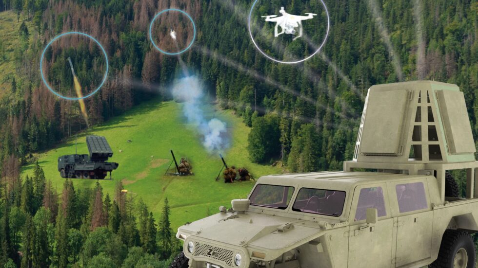
Unauthorized flights, often by unregistered drones or operators without proper certification, pose public safety risks. Authorities currently manage drone operations using a combination of methods. Cellular-connected drones can improve enforcement: an unregistered drone would be unable to access the network and therefore could be blocked. During handover between base station cells, network-side features such as Doppler shift and flight trajectory can help identify a device as a drone and notify management platforms to restrict its behavior.
Ground platforms gain more accurate situational awareness of flight information, including position, altitude, speed, heading, and battery state, making it easier to implement geofencing and no-fly zones.
Autonomy and Swarming
With 5G, cloud resources, big data, and AI, drones are expected to move toward increased autonomy. Flight control has progressed from remote piloting to sensor-assisted stabilization, basic autonomous flight, and obstacle avoidance. Future drones will aim for fully autonomous flight, with flight paths and behaviors determined by onboard systems and supporting platforms that enable sensor sharing, route sharing, environment perception, and intelligent avoidance.
5G also facilitates swarm coordination, enabling multiple drones to collaborate on tasks with reduced human intervention.
Conclusion
5G-enabled drones will be a key component of future digital airspace. Industry projections have anticipated large growth in drone units and market value. If 5G deployment proceeds smoothly, it is likely to further stimulate these trends. The convergence of 5G and drone technology is an example of cross-industry digital transformation and may provide insights for deploying 5G in industrial IoT and other sectors.