Core Technologies Driving Electric Aircraft Development
Technical overview of electric aircraft, covering electric propulsion, battery specific energy needs, high-power motors, power electronics and system design.
Aerospace electronics represent a critical frontier in modern engineering, where precision, reliability, and innovation converge to power the systems that enable flight, exploration, and defense. This category delves into the specialized world of printed circuit boards (PCBs) and electronic components designed for the demanding environments of aviation, space travel, and unmanned aerial vehicles. From high-altitude aircraft avionics to satellite communication modules, aerospace electronics must withstand extreme temperatures, vibrations, and radiation while maintaining flawless performance. In this collection of articles, readers will find comprehensive guides on designing robust PCBs for aerospace applications, including material selection for thermal management and signal integrity in harsh conditions. Tutorials cover practical techniques such as implementing redundancy in flight control systems and integrating sensors for real-time data processing. Insights from industry experts reveal emerging trends like miniaturization for lightweight drones and the role of AI in predictive maintenance for spacecraft electronics. Best practices emphasize compliance with standards such as DO-254 and MIL-STD-461, ensuring safety and efficiency in mission-critical projects. The real-world value of aerospace electronics lies in its direct impact on advancing technology that shapes global connectivity and exploration. Engineers and designers can apply these concepts to optimize power distribution in electric propulsion systems or enhance cybersecurity in networked aircraft. By examining case studies from commercial airlines to deep-space missions, this category equips professionals with actionable knowledge to tackle complex challenges. Delving into these resources fosters a deeper understanding of how cutting-edge electronics drive progress in the skies and beyond, offering tools to innovate and solve problems in this dynamic field.
Technical overview of electric aircraft, covering electric propulsion, battery specific energy needs, high-power motors, power electronics and system design.
Understand China’s UAV regulations for DJI drones: real-name registration, pilot license requirements, geofencing, and operational limits. Technical insights on how regulatory compliance affects drone electronics design, remote ID modules, PCB integration, and manufacturing for consumer and commercial UAVs.
U.S. Air Force trial uses drone inspection and AI to accelerate C-17 aircraft checks, improving detection rates and delivering mapped, analyzed imagery for damage assessment.
Technical overview of multi-platform cooperative guidance for shipborne SAMs, defining guidance handover processes and CGU functions, modules, and information flows.
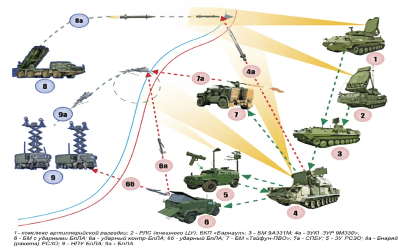
Operational analysis of air-defense deployment and Tor-M2U/Tor-M2 workflows against UAVs and precision-guided munitions, and integrated countermeasure recommendations.
Overview of counter-drone systems covering detection, surveillance, tracking, and interception methods, including electronic jamming, radar, infrared, and lasers.
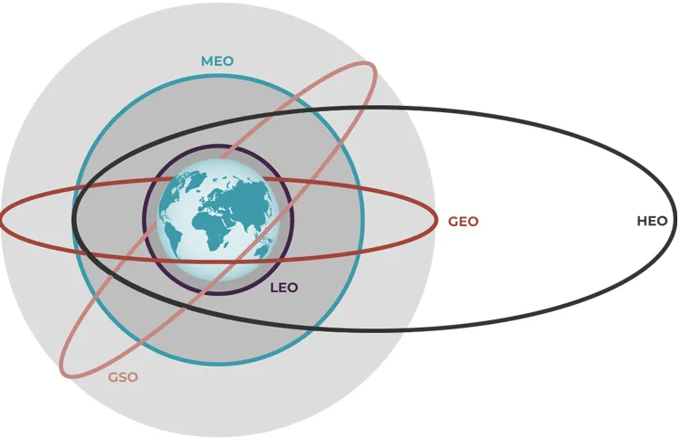
Technical overview of satellite orbits and the evolution of satellite communications, focusing on LEO characteristics, GEO/MEO/HEO comparisons and emerging NTN standards.
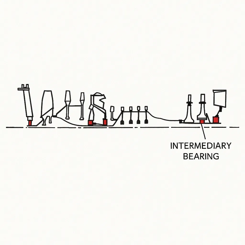
Analysis of gyroscopic torque and rotor deformation in twin-rotor turbofan systems, comparing co-rotating and counter-rotating rotors and design implications.
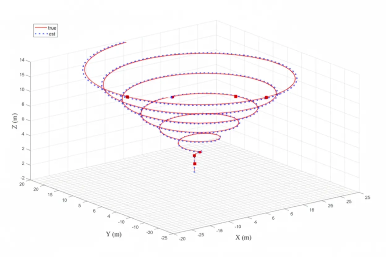
Study of a low-cost adaptive trajectory controller for quadcopter obstacle avoidance using NLVG-PID with extremum-seeking to reduce overshoot and settling time.
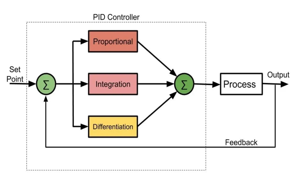
Explains how PID feedback differs from open-loop control, how controller outputs map to physical units (acceleration, force, lift/throttle), and when scaling suffices.
Analysis of future air and missile defense challenges, threat categories (system, platform, weapon, technical), and technology trends with emphasis on artificial intelligence.
Technical overview of military drone swarm tests and capabilities, and core technologies: drone swarm coordination, swarm control algorithms, and network communication.